Ground Penetrating Radar Training< Back
In February and March, our Joe Moorhouse and Joe Doggett attended two training courses. The first was based around understanding the theory behind ground penetrating radar (GPR), how to deploy GPR on site and the types of GPR on the market. The second course was focused on post-processing the data collected on site when back in the office, varied options of presenting the data and which programs are available for post-processing.
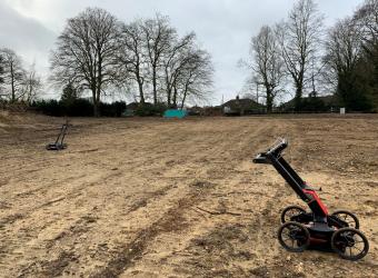
Ground penetrating radar is used to generate a scan of the subsurface by firing radar pulses from an antenna into the ground. These pulses reflect after coming into contact objects within the ground, such as rocks, changes in substrata layers or buried services. A receiver within the GPR then translates the time taken for the signal to leave and then return to the device to calculate a depth of an object underground. Within our utility surveys at Plandescil, we predominantly use the GPR to identify services buried underground. However, we can also use the GPR to look for areas of contamination on site, ground disturbances and voids.
The GPR can emit varying frequencies to detect subsurface objects, with lower frequencies transmitting deeper into the ground but generating a less accurate picture than high frequency radar which produces a clearer image but has a reduced penetration depth. We own a Mala GPR that transmits at one frequency and a Proceq GPR that has a stepped frequency which can scan at multiple frequencies. Using multiple frequencies gives us the best chance of clearly and accurately identifying points of interest underground.
Our GPR's contain one transmitter and one receiver. However, there are also array GPR's available on the market that have 32 radars attached, some facing longitudinally and some laterally, making scanning a larger area very easy and accurate. Furthermore, there are also some that can be attached to vehicles, recording data at up to 70mph, removing the need for traffic management for some schemes.
The second course had a focus on post-processing data recorded on site. It demands a different type of GPR survey, requiring a grid to be recorded on site, preferably with 1m spacing. This is opposed to our general site methodology of marking the ground with spray paint and surveying with the GPS. Once the data has been collected, it can be uploaded to various programs and the scans can be viewed as ‘time slices’. This is where all the scans for a certain depth throughout the site can be viewed at the same time, making it very easy to pick pipes from the scans. For example, a depth of 0.6m deep could be set for the whole site, highlighting which areas of differing properties were recorded at this depth. If these areas formulate a line throughout the site, it would be safe to assume this was a pipe at 0.6m below the subsurface. A rectangular area of disturbance shown at the surface and in every time slice down to 1m deep could signify a manhole.
Post-processing data in this way can allow you to work in 3D, which could allow us to show utilities in 3D Revit models. Furthermore, the location can be presented on OS data or on Google Earth, allowing the client to clearly see what has been surveyed and where. As it is vital to provide work in a format that is desirable to the client; utilising GPR post-processing software can expand the range of output we, as a company, can produce.
"These training courses have improved my knowledge around GPR, increased my confidence in deploying our GPRs on site and have provided an opportunity for us to offer a greater repertoire of GPR services." - Joe Moorhouse